One of the very few problems with doing archaeological work on Prince Edward Island is that for a good 5-6 months of the year, you have to spend it indoors thanks to this terrible thing called Winter. In Canada, it’s a time when snow flies and temperatures plummet (to people living in equatorial or sub-equatorial locales: Yeah, I know, you guys have this season as well. But this is the real Winter, so spare me your horror stories of “frigid” 20-degree Celsius days/nights). Of course, Santa Claus pays a visit during this time, but that’s about the only positive thing I can think of. Anyhow, let’s get this thing back on topic.
I suppose in a way it’s probably good for us to have to spend some time inside, or else we’d never get anything done in the way of post-excavation processing, research, and report writing. But when you turn that corner in April and things begin to warm up a bit, you get this itch, a really annoying one, and the only way to scratch it is to hit the field. This year, we scratched that itch with time spent down at the river – the Cardigan River, to be precise.
For those of you unfamiliar with the geography of Prince Edward Island, the Cardigan River is one of three major (Canadian heritage) waterways that form the Three Rivers, along with the Montague and Brudenell rivers. These tidal estuaries have played a significant role in the history of eastern Prince Edward Island, beginning with the first Aboriginal peoples thousands of years ago and continuing into today.

Satellite image of Prince Edward Island with the Three Rivers system circled.

Close(r)-up view of the Three Rivers.
Because of the importance of these rivers to Island history, we decided that it might not be a bad idea to begin a systematic survey to assess their archaeological potential. Given the size of the rivers, however, a project like this is a massive undertaking, which we knew. But if there’s one thing we’re used to, it’s big projects (*cough* PAV *cough*).
Remember that itch I was talking about? Well, we had it real bad back in April. It was so bad, in fact, that on April 23 we threw caution to a brisk northeasterly wind and hit the open road for Georgetown, 10-degree Celsius reading on the thermostat be damned. The sun was shining as we sped along the Trans Canada in our red Dodge Caravan rental, and morale was surging. All hail being in the field!
Anyway, we had decided on a jumping-off point at the end of the Earl Power Road, on the left just before you enter Georgetown proper. I’ll admit, it may seem like an arbitrary place to begin a survey; however, we had been tipped off to an arrowhead having been found in the vicinity, and so we thought that that would be a good place to kick things off. After a quick bite to eat, the six of us (Dr. Helen Kristmanson, Meghan Ferris, Dawne Knockwood, Smantha MacKinnon, Alicia Compton , and myself) piled out of the van, artefact bags in hand, and made our way down to the shore. We headed ENE towards the mouth of the river and straight into a relentless wind that chilled us to the core for the nearly three hours that we surveyed. I won’t lie, it was rather brutal, and I’ll admit my snotsicles were pretty atrocious by the end. (FYI, “snotsicles” are “snot icicles”, an unfortunate reality of the cold Canadian climate.) Anyway, here’s a Google Earth snapshot of our travels:

Our travels on April 23. The arrows indicate direction, obviously. I did them up in Paint, which is why they look so childish.
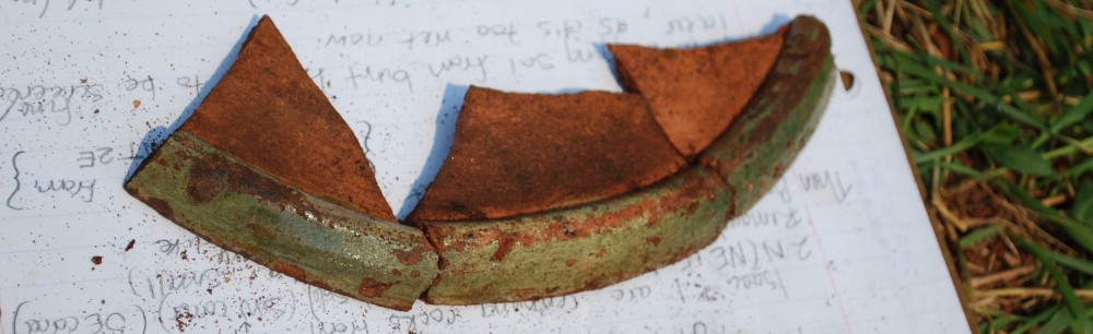
As you can see, we started out by walking the beach along the bank, and didn’t go all that far before turning back and investigating that largish spit of land you see above, essentially a big, flat sand dune. Along the way, we encountered quite a bit of recent detritus, but also found numerous historic artefacts such as ceramic sherds, glass, and the odd chunk of metal here and there, probably associated with these residents shown in Meacham’s 1880 Atlas of Prince Edward Island:

Unfortunately, nothing Aboriginal was found, despite our insider information.
Entirely frozen, we finished off the day by putting in at the nearest Tim Hortons (coffee shop) in Montague in an attempt to stave off hypothermia, and decided to take stock of our artefacts and write up some field notes. We drew quite a few furtive and sideways glances, so something tells me that people in deep discussion with Ziploc bags full of odds and ends spread out over two tables and poring over maps and aerial photos isn’t a very common sight at that establishment.
Well, that was the first day in the field for 2013, and also the first day of our survey of the Three Rivers. Despite good intentions, we were unable to continue with that particular survey work because of other commitments, but it is definitely a project that we will be resuming in the future…hopefully when it’s warmer.
And now for a photo recap.
-

- A shot looking ENE. And yes, that white stuff toward the upper right is snow…in April. Welcome to Canada!
-

- A blurry shot, quite possibly of Meghan Ferris all bundled up.
-

- Another shot looking ENE. Our turning-around point was that field in the background.
-

- Bogarting some tables at Tim Hortons. In this photo (clockwise, from top): Samantha MacKinnon, Dawne Knockwood, Meghan Ferris, & Alicia Compton.
-

- Basically the same picture as before, only this time I’m in it…which is why I threw it in.
See you in the next post!

